 Live Music Archive
 Librivox Free Audio
 Metropolitan Museum
 Cleveland Museum of Art
 Internet Arcade
 Console Living Room
 Books to Borrow
 Open Library
 TV News
 Understanding 9/11
tv News 4 Today at 6 NBC September 30, 2010 6:00am-7:00am EDT
6:00 am

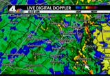
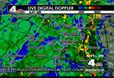
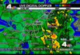
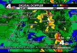
super oaker. whii t t old mann been snong, the rain it's been pouring. take aook this. nothing but rain everywhere acrss themap. the entire area is under a flash flood warning, and a tornado watch. >> as you might expect the roads are a mess thrghout the area. we have high water, closed roads and accidents. good morning, and thanks for joining usfor "news 4 today," i'm eun yang. >> good morning to you. i'm joe krebs on a thursday, the 30th and last day of sepmber, 2010. let's take a live look outside once again. this is ronald reagan international airport where it raining heavily. flights could be delayed upnd down the east coast. >> let's get the latest on the forecast. meteorologist tom kierein is following all this heavy rain. tom, good morning. >> good morning eun and joe. yes, we've seen these waves of heavy rain really increasing in intensity over the last three or four hours. they've been marching in south to north and continue to sweep through. this is the radar over the last
6:01 am
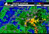
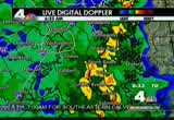
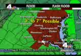
three hours. we've seen pockets of yellow and orange. those are the areas of the heaviest rains that have been coming through. also thunder and lightning over the eastern part of the chesapeake bay. and on the eastern shore of the chesapeake bay they are geing heavy downpours right now. now the radar locally is showing a few pockets of moderate to heavy rain in fairfax county and montgomery county as well as ince william. another pocket of very heavy rain in southern prince william. all of these are heading off to the north. one band of very heavy rain moving off to the north and northeast, and will be sweeping across the western part of the eastern shore here over the next half hour, or so. when you see the areas of lighter green or blue where it's not raining quite as hard, another pocket of very heavy rain is about to come into southern maryland. they've already had over four inches of rain. all these counties in red reporting flooding. water over roads in many locations, ponding of water and maybe some floodingn your basement, too. we've had about an inch and
6:02 am
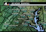
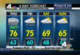
two-thirds in washington, nearly three inches in the nearby suburbs. over four inches in southn maryland. 60s and near 70s now. we have a tornado watch that's in effect until 1:00 this afternoon for much of the region. then wll finally dry out tomorrow. cooler weekend to foow. how is our traffic. >> following breaking news in maryland with the jackknifed tractor trailer accident that s literally stopped all traffic on the capital beltway. this is shooting from the bradley boulevard overpass the inner loop of the capital beltwa between the i-270 spur exit, and old georgetown road. right now just around the bend, it's jackknifed tractor trailer that occurred just a short time o. authorities are on the scene reporting back to us. very little, if any traffic is getting by on the inner loop. folks to the left side of your scrn, heading up the i-270 spurt. that's what you want to do if you can. focus your attention on the spur, head northand you can detour around this beltway crash in that fashion. in the meantime, do not commit
6:03 am

to the inner loop of the capital beltway, as it is virtually blocked now after the exit for i-270. let's head over, 95 northbound near dale city. it is a parking lot stafford all the wayup to the capital beltway this morning. a series of accidents, virginia state police have been racing tao all morning long. quickly out to the rails, metrorail's having a good morning. vre not so much fredericksburg 302 is delayed, manassas 322 and 324. m.a.r.c. looking good at the moment. roads are extremely slick this morning. if they're even passable at all. tracee wilkins is live along the beltway near bradley boulevard in bethesda with more on this serious accident this morning. >> reporr: good morning, eun. we're going to show you what it looks like on the inner loop of the beltway heading toward wisconsin avenue. major, major backup. we're told that a truck has jackknifed right up the road
6:04 am

here. and as a result of that, all of the lanes are closed. traffic is getting by on the left-hand shoulder. not even a real wlan at this point. there is a fuel spill here up the road so they're dealing with all of this, trying to get it cleaned up, waiting for a tow truck to come so they can get that truck out of the adway. they're going to move it over to the right and tow it out as soon as they possibly can. this is causing a major backup. folks need to pay very close attention. be very careful. as i was speakingo you ijust saw a car get over from the beltway, try to get over to the i-270 spur here and thatwas very frightening right in front of a truck. folks have got to be careful. drive slowly, give yourself some room. give the vehicles in front of you some room. we're seeing some serious acidents. this is terrible rain out here. tracee wilkins, live this morning. >> expect to see a lot of scenes like that one this mning. tracee, thanks so much.
6:05 am

the biggest story we're covering at the moment is this rain and the flooding. the highways are moving very slowly and many low-lying spots are already covered by rising water. megan mcgrath is live in kensing condition wherehere are some flooding conditions there already. good morning, megan. >> reporter: good morning, joe. we've got a flash flood warning in effect and we are seeing some flooding on beach drive in the kensington area you can see that they have the road closed at connecticut avenue. low-lying areas, ofcourse, they are the first to flood circumstances like this. if you noally travel to an area that's prone to flooding, really, think of a different way to make your way in to work this morning. because chances are it is not in good shape. we hav had steady rain now for hours. we have several more hours of rain still ahead of us. the road conditions have been deteriorating all morning long. you heard jerry talk about the accidents that have begun to stack up on primary roads as well as secondary roads. just ugly, ugly conditions out there. we're seeing pooling water, ponding water, areas that don't
6:06 am

have good drainage. we're seeing problems on those. 're not just talking secondary low-lyingareas. we're also talking some of the major roads. we've got reports of some high water in bethesda, about a foot ofater in the wisconsin/montgomery avenue area. so just very, very treacherous conditions. take it easy out there. keep your speeds down. we aso have a tornado watch affecting most ofhe viewing area until 1:00. joe, back to you. >>egan mcgrath reporting live. thanks very much, megan. try to stay dry ifou can. right now many people are waking up in the dark, though. pepco reports 1200 people are without electricity in montgomery unty, prince george's county and the district. bge reports about a little over 500 without power. dominion reports nearly 200 without power in northern virginia. >> here's a look at what the storm system has already done else where. the remains of tropical storm nicole dumped heavy rain in
6:07 am

southeast north carolina. the rain is putting a strain on area rivers and streams already overflowing. some roads are impassable becse of deep water. i-270 is open again after that terrible and deadly crash involving a tour bus. all northbound lanes were closed for hours, after the bus, carrying children and their parents, plunged off an hov flyover ramp and rolled down a hill coming to rest just inches from the very busy interstate. the 66-year-old bus driver was killed and at least dozen people were injured. they are all pected to be okay, though. doctors who treated the victims say this accident could have been much worse. >> actually the thing that stands out about this accident is the fall seems pretty significant. the mechanism, the physics behind it. i'm surprise that there weren't more severe injuries. >> investigators are still working to determine what did cause the bus driver toose control of that vehicle. coming up, more confusing news for women about who should
6:08 am

and shouldn't get a mammogram. what you need to know. >> new information from intelligence agencies about the terror threat targeting major european cities. >> and take a look at this. heavy rain is coming down flout the area. all ofthis rainy weather is creating a wet, messy commute. 69 degrees. a mess out there on 270 your traffic and weather together on the 1s are next. my dad is the supervisor of a train station and my mom's a teacher. dad's an auto technician. my mom's a receptionist. i'm not sure i wou have been able to afford college without the tuition free. while tuition in other states is rising out of reach.. governor o'malley ma the tough choice to frze tuition. he made myream of going to college into a reality.
6:09 am

i'm the first in my family to go to college. my brother and i never would have been able to afford colle. even though times were tough... govern o'malley pt his promise. there's never a doubt... there's never a doubt whose side hs on. martin o'malley... moving maryland forward.

6:11 am

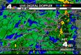
ime for weather and traffic. good morning on this thursday morning, waves of moderate to heavy rain continuing to sweep across virginia, the district of columbia, maryland, the east and west virginia and this has really picked up in intensity over the last three hours. you see those areas of yellow and orange where it's coming down hardest right now. north and east of washington, across the bay on the eastern side of the bay. that's advancing to the north. another pocket of some very heavy rain now in montgomery county. and across the potomacriver into loudoun county. a few other pockets of heavy rain now st. mary's county where they had over four inches of rain. and route44, and st. mary's county, water over the road. north beach and calvert county reported flooded roads. route 17, spotsylvania county near bevel dean reporting water over the road. and we will continue to see the waves of rain coming through. all these counties in red reporting high water on many area roads, small creeks and streams out of their banks.
6:12 am
ponding of water, as ell. we have a tornado watch in effect until 1:00 this afternoon for most of the region, and we'll have this rain from time to time in waves, heavy at times, allhe way in to early this evening, tapeng off and ending by midnight tonight. and then a blustery wind tomorrow as we dry out. cooling down for the weekend. erry, how is the traffic now? >> we continue to llow breaking news on the capital beltway, in maryland, with a jackknifed tractor trailer. virtually blocking the entire inr loop of t beltway, just after t exit of the i-270 spur. but before you get to old georgetown road. right now, authorities are on the scene trying to get the tractor trailer squared away. in the meantime the beltway is delayed coming up from river road, growing very, very quickly. if you're planning on heading thatdirection, don't. second option take the 270 spur and circumvent the delays that way. right now very little traffic geing by on the inner loop. let's head on over speaking of 270. southbound traffic pretty good here in germantown.
6:13 am

however, that's a little deceiving. just down the road a new accident ju reported with two lanes closed off, 270 southbound at falls road. i'm sure that authorities are dealing with more accidents before this camera. we'll keep u updated on that. elsewhere, this is 95 virginia, where we've had a series of accidents. latest of which here, dale city, still being tended to. so right now from at least triangle all the way on up it is more stop than go. >> thank u, jerry. >> jerry, thanks very much. 6:13. 69 degrees. watch and listen to this. rember the times square bomb plot? the fbi shows off the power of the explosion had it gone off and reveals the details of yet a second plot. >> and we're watching the weather and the roads as heavy rain continues to pound the area. stay with us.
6:14 am

equals chili's $20 dinner for two. share one of five appetizers, like our famous texas cheese fries. then choose two freshly prepared entrees from 14 chili's favorites, like our chicken crispers with new sweet & smoky sauce, our new slow-smoked honey chipotle baby back ribs,
6:15 am

or grilled all-white meat chicken fajitas served over a bed of sizzling peppers and onions. grab a friend and get one appetizer plus two entrees with chili's $20 dinner for two. 6:16 is your time now. 69 degrees. you're taking a look at the beltway on the right and radar on the left. look at all that rain.
6:16 am

it is creating a lot of problems out there on the roads. meteorologist tom kierein will have your forecast in just a few minutes. invest gators are still working to dermine if yesterday morning's deadly fire in northwe washington waset intentionally. it's a story you saw first on news 4. one man was killed when he jumped to escape the fire in the 3100 block of 16th street in columbia heights. four others,ncluding a 2-year-old girl, were seriously hurt. firefighters believe the fire started on the fifth floor, and they are calling it suspicious ght now. classes at prince george's community college will resume today after a gas leak shut everythindown yesterday. the leak happened just after 8:00 yesterday morning when workers accidentally ruptured a four-inch natural gas ne. authorities said there was never anydanger of an explosion, but roads in the area were closed and the school was closed, as well, as a precaution. theas line has been repaired. we're getting a look at just how powerful the times square bomb would have been had it
6:17 am

detonated earlier this year. take a look. that was an fbi re-enactment of the bomb. fail shahzad said he thought he would kill about 40 people. he pleaded guilty to all ten counts against him back in june. court documents say he was planning to strike many times. prosecutors say that shahzad studied new york city web cams to observe foot traffic around the area. he also said he wanted to, quote, join his brothers in jihad since 9/. shahzad will be sentenced next week. meanwhile, there's now new information about the terror plot targeting major european cities. officials say ere is increased chatter from various sources that paris is considered to be a target. thousands of additional police and militaryersonnel have blanketed that city as a precaution. and it's not just in france. according to intelligence sources in gmany, german jihadists who fought for al qaeda in pakistan and afghanistan are now coming back
6:18 am

home to continue the fight. and tourists are being affected by all this bause of the several bomb threats the eiffel tower has been shut down twice over just t past two weeks. >> montgomery county fire and rescue joins us live this morning. good morning. >> good morning, eun. >> thanks for joining us. first of all, could you talk to us a little bit about the crash yesterday on 270. you were on the scene tell us about it. >> well, just after 4:00, a limousine-style tour bus, a 29-passenger bus, was traveling northbound on 270 from the direction of old georgetown road. it was a group of adults and ildren that were coming back up from visiting the washington mall, and the natiol zoo. just before they entered the flyover ramp, which is the hov lane to northbound270, the bus left the road, went through the guard rail, and struck the jersey wall abutment, which caused the bus to actually roll
6:19 am

down a 45 foot embankment coming to rest on the jersey wall which was protecting northbound 270 coming from the direction of democracy boulevard. >> thanks for that. let me move on just because of the conditions of this day and talk a little bit about the dangers of flooding. i know that fire and rescue often get caed from people whose basements, in particular, get flooded or they get worried about their homes being flooded. what particular concerns should homeowners have about flooding, especially dangers, if your basement gets flooded, what about your furnace, electricity on there. how dangerous a situation can that be for folks? >> well, dependinon the type of uilities you have, whether it's gas or electric, you certainly want to call a ofessional if, in fact, a gas furnace ha been flooded to relight the pilot light, to make sure that the -- there are no
6:20 am

leaks in the home. if you smell gas, naturalas within your home, call 911. you want to remove folks from the home if you have that odor of gain the home. you know, there are a lot of issues that we're monitoring this morning with the rain and flooding conditions. our special operations chief, special operations section, they're monitoring the roads. we know of about 25 or 30 trouble areas that we have in the county, as it relates to roadway flooding. so many things in yourhome, you know, basements, if you hve a sump pump and you lose electricity, obviously we're going to get some flooding there. if there is no life threat or there is no life in danger, utilize our 311 system. >> all right. >> we can get to your services and direct you from the 311 system, as well. but if there is any threat to life, certainly call 911. >> okay.
6:21 am

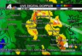
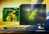
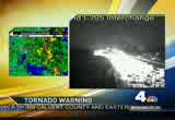
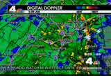
assistant chi of the montgomery county fire and rescue, chief scott graham, thanks so much for joining us today. good luck today. >> thanks. >>it will be a challenging day, i think. >> more developments, let's go right to meteorologist tom kierein in the storm center. >> we are under a tornado watch, meaning the conditions are right for potentialornadoes to develop, and now we do have a tornado warning, meaning, on radar we are seeing some circulation that could be producing a tornado in st. mary's and in calvert county. right now as we look at the closer view on the radar, down there in st. mary's county, we are getting some circulation re on the radar. it does appear that this particular storm may be producing a tornado. now, the location's impact would be the naval air station, town creek, saint letter creek, calvert cliffs, this system is heading off to the northwest, and this is the particular cell here that may be producing a
6:22 am
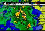
tordo. a little bit of a circulation heren the radar, and we don't have any reports of a funnel cloud touching down yet, but we do have an indication on radar that this storm could be producing a tornado. again a tornado warning for southeastern calvert county in southern maryland, and eastern st. mary's county in southern maryland until 7:00 this morning. it could affect pax river naval air sttion, saint leonard creek, greenwell ste park and calvert cliffs. and that is heading off to the north and west. elsewhere on the radar we have some other pockets of very heavy rn that are farther to the north across the bay, and just now near camp island and moving toward queen anne's county. other pockets, ver heavy rain in montgomery county and southern frederick county. western loudoun county the panhandle ofest virginia here in jefferson county, getting some very avy rain, as well. so this area of rain, with a potential tornado here in st. mary's and in calvert county,
6:23 am
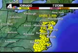
this is heading off to the nrth and west. and it is perhaps going to be heading into charles county, and into prince george's county. may not be a tornado. butcertainly some heavy rain with maybe blustery winds heading that way. right now right near washington where you see the green and blue, the rain is a little bit lighter. but here comes another surge, though. that will continue to movein here, perhaps, in another half hour or 45 minutes. right around 7:00. we'llave another wave of very heavy rain, coming in to washington, and much of the region, we've got flooding. all these counties in red have flooding. right now, under way, water over many roads, here in t nearby suburbs of washington, as well as in the district of columbia, and in southern maryland and parts of northernva. flooding is occurring right now. total amounts of up to seven inches of rain before this all tapers off and ends this evening. here is the tornado watch area. tornado watch area does cover eastern virginia, the district of columbia, northern virginia, and much of maryland, and the
6:24 am
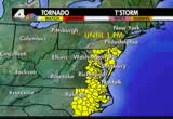
eastern shore. this tornado watch means conditions are ripe for individual storm to produce a funnel cloud. this is in effect until 1:00 this afternoon. along with heavy rain, more flooding likely later today, as well. highs reaching the mid 70s. right now, it's in the 60s to near 70. and then tomorrow, we'll be drying out. the rain can taper off and end by midnight tonight. blustery winds tomorrow with partly cloudy skies, highs reaching the mid 70s. then as we get into tomorrow afternoon and evening, we'll see they're getting quite chilly. only in the 40s on saturday morning. saturday and sunday afternoon, we'll have it into the mid 60s to upper 60s andt will be partly cloudy. another chilly start on sunday morning, and as we get into next week there could be some more unsettled weather moving our way with highs in the 6s to 70s by midweek. but again we do have a tornado warning in effect for southern maryland, it includes eastern st.ary's county, and southern calvert county. this is a particular storm here that shows sme circulation on
6:25 am
the radar that i now heading off to the rth and a bit to the north and west and will be affecting southern calvert county. you do see storm coming your way. take cover, move to an interior room of your hou or to the lowest floor of a security building and aid the windows. that's for sure in this area of southern maryland in st. mary's county, and in calvert county. and you still definitely want to stay tuned here. we'll keep you posted as this morning progresses, because we could have some more severe weather in addition to the flooding rain that will continue to sweep through the region from time to time over the next several hours, and the wider view of the radar, again showing that this wave of rain does continue to come in from the south and east. we've got another pocket of some very heavy rain. even farther south of st. mary's. that, too, is going to be moving in and heading off to the north and west, and perhaps impacting the metro area as we get into the later part of the afternoon hours. now let's check the impact on
6:26 am

trfic around the region. jerry, how's it looking? >> m, very miserable. we'll start on the maryland side, inner loop of the beltway, right side of your screen. authorities are trying to remove a jackknifed tractor trailer on the inner loop just after the exit of the i-270 spurt but old georgetown road. right now police are telling us the shoulder may be getting by under police direction. right now we're just going to say that all traffic is blocked so stay away from that stretch. 270 spur the left side of your screen is the alternate. but what's very dangerous now, folks are actually stoping in the travel portion of the northbound spurt, trying to merge over here. because obviously they don't know the beltway's shut down. so, st up with us we'll keep you updated on that. now 270 southbound has been difficult all morning long. here's the latest accident near falls ad. fire and rescue crews are on the scne the. we've had accidents, several stretches of accidents and right now it's a virtual parking lot from at let german town.
6:27 am

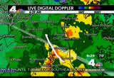
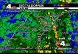
more likely at lea clarksburg now all the way on down to the capital beltway. one more stop to go around, a series of accidents on 95. latest of which is in dumfrie authorities are dealing with that from well before triangle onto the beltway and 395. it is more stop than go. extra travel time. a lot of patienc and bring your brain with you this morning. joe, eun? >> pay attention this morning, jerry. thank you. >> speaking of paying attention. we're going to continue to pay attention to the weather out there. it is continuing to develop in our area, here's tom with more in the weather center. good morning, tom. >> just a few minut ago the radar picked up some circulation in a thunderstorm cloud over southern st. mary's county, and in easternt. mary's townpy that's headi towards southeastern calvert county southern maryland. and the radar is picking up this indication of a circulation just a few minutes ago. now the closer view of the radar let's zoom in on southern maryland and we can see where this particular storm is right
6:28 am

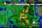
now it's the one near solomon. this could be the one that is maybe producing a funnel cloud. this is heading off into the these communities here perhaps over the next 15 minutes or so. to include part chesapeake up towards long beach and calvert cliffs as well as california, town creek, greenwell state par that area. this is heading off to the north and west. and this is moving rather quickly. so if you do happen to see a funnel cloud or you sense that some strong winds are coming toward where you livethere, definitely take cover and move to an interior room or the lowest floor of your home and avoid windows, and definitely move to the closest substantial shelter if you find yourself caught outside. and as we look farther to the north here on the radar. we are also getting some areas of very heavy rain now falling just to the north now coming towards huntingtown in calvert county. weatr watcher there just reported over three inches of rain there, and here comes another wave. they've had over four inches in st. mary's county just heading
6:29 am
off into prince charges county. this will be moving up that way in the next 15 minutes so with another round of some very heavy rain. the pockets of yelw also in frederick county, panhandle of west virginia. so we'll have waves of heavy rain with more flooding likely and perhaps some seve storms as the morning progresses. we'll be back with frequent updates. eun and joe? >> tom, thank you. >> thanks very much. >> of course the biggest story we are covering at the moment. flooding as jerry has been showing us,s there are problems all across the area. many low lying spots in montgomery county arealready covered by rising water. >> megan mcgrath is live now with flooding conditions. you're at beach drive and connecticut, is that right, megan? >> yeah. beach drive and connecticut, and beach drive is closed. this, of course, is a low-lying area that's prone to flooding. and we are seeing low-lying areas start to become trouble spots. that's been a situation all morning long. we are also starting to see a lot of pooling and ponding water out there on the roadways. of course the timing of the storm is just terrible.
6:30 am
right during rush hour. people trying to head out to work. kids trying to get off to school. and this is going to stick around for sveral more hours. let's look at some of the trffic cameras. maybe the beltway and 270, can you see the traffic situation there, just a steady rain coming down. we're getting reports of road closures throhout the area. there's another trouble spot at prosperity avenue and morningside drive in irfax. that area the road is closed ecause of standing water, and this is an ongoing situation. we are not expecting the rain to let up for several more hours. we've got bands that are coming thugh the area that are rather heavy at times. just take it easy out there. >> all right megan mcgrath. >> thanks so much. t's go back to tom right now. he's continuing to watch the situation, especially down in southern maryland around solomons where it looks like there might be a posble tornado. >> possible funnel cloud. we don't have any confirmed reports of a touchdown yet but we do have an indication on the raar of some circulation in a
6:31 am

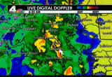
thderstorm cloud that is in southeastern st. mary's county, as well as in sthern calvert county in southeastern calvert county. this is advancing to the north. you can see the entire flow of the atmosphere is moving from the south to the north. all this precipitation and storminess associated with the remnants of trocal storm nicole, that is spinning over the carolinas right now. that's going to be heading our way. now this is the particar storm. it does look like it may be weakened a little bit, as it did passing off to the north. this could be the storm right now producing a funnel cloud. lso this one, this one may be a storm oducing a funnel cloud, as well. and then we've got another one up here, too, that's just how pulling to the north into calvert county. here's waldorf and charles county. now this may be heading towards that way as well as into southern prince george's county in the next w minutes. and don't have any indication of any touchdown yet, but the radar is showing some circulation to that storm. it is n heading toward lugby
6:32 am

in sohern calvert county. and this wave of very heavy rain here that we see in central calvert county is going to be crossing into prince george's county in the next 15 minutes or so. even though we have a lull in the rain here in washington right now, this area of green is just some lighter rain that's falling now. here comes this next big wave of heavy rain maybe with circulation that could produce damaging winds. that's going t be tracking up right toward the metro area here in the next 15 minutes or so. already the leading edge of that very heavy rain is just now coming in to southern prince george's county. eastern charles county. out of northern st. marys. so we have several cells here that could be producing circulation. perhaps producing a funnel cloud. that's why we have a tornado warning in effect for northern st. mary's, and in calvert county where the next half hour or so until about 7:00. this may be extended farther to the north if these particular storms do hold together and
6:33 am
continue to show some intensity increase in the next several hours. now, the wider view of the radar showing some other areasof very heavy rain that's falling when you see this yellow in montgomery county right now. that one cell is producing some very heavy rain, right near gaithersburg, and up towards olney and near laytonsville and damascus. that one is going to b tracking up right towards dascus shortly with some very heavy rain. and then acros the frederick county line into frederick county. there is another 30kate of some very heavy rain there, too. that is going to b tracking up towards the north. now, farther to our west, the radar is showing a pocket of some very heavy rain that is in the panhandle of west virginia. an we have a lot of viewers there. that is posing qukly off to the north. so ma creeks and streams may start coming out of their banks, too, from martinsburg wn to charlestown and then across the line into southern washington county maryland near sharpsburg. and the antietam national battlefield park there. that isassing off to the north.
6:34 am

and burktsville, they're getting a very heavy downpour there right now. now farther to the south in loudoun county, it's not raining quite as hard there. but, stand by, there's going to be some more heavy rain beginning to move that way, as well as in to perhaps southern frederick county. you may g another wave there. but what is the greatest importance right now is southern maryland. this is the area where we do have a tornado warning in effect for parts of northern st. mary's county, as well as eastern calvert cnty. now this is the particular cell at did show some circulation in it. there may be a funnel cloud from near salmons up to chesapeake and near lugsby, long beach, as well as right around california, town creek, saint leonard creek, greenwell state park, calvert cliffs. this whole area here, there could be circulation here. there may be a funnel cloud touching down. these are all indications on radar where you s these orange cells. this is where 's raining
6:35 am
hardest. and these are the zones that might have some circulation, and perhaps some small funnel clouds that will be coming onhrough here or the next half hour or so. heading off to the north an northwest. now, how's all this rain impacting traffic, jerry? >> very tough morning. we said it before, extra travel imes. lots of patience. you're looking at a live picture of the capital beltway's inner loop in montgomery county. authorities are dealing with a jackknifed tractor trailer. virtually blocking all lanes of the inner loop between the exit for the 270 spur and old georgetown road. right now, very little if any traffic is getting by. you want to definitely avoid that stretch of road. let's head over and update you along i-270. police are still dealing with an accident, southbound near falls road, right there. right si of the roadway, just one a series o accidents that we've had this morning. accidents on the beltway, in virginia, on the outer loop at van doren street with a couple
6:36 am

of lanes closed. so far just volume, no major accidents over on 66. quick check elsewhere. head on over and update you, 95, virginiathis is just one of about five accidents we've been following so far in the stretch between triangle and the ltway. so just be forewarned. . joe, eun? >> indeed. thanks very much, jerry. we're going to take a look at the inner loop of the beltway whe there's been that bad accident. tracee wilkins is on the scene. >> all we see are brake lights at this point? >> oh, yes, definitely. because all of the lanes are closed. traffic is only getting by on the shoulder. definitely a lot of brake lights. but we are seeing that traff is moving at a very slow clip. right now they're working to get that jackknifed tractor trailer out of the roadway. this is a dr that jackknives up the road here and as jerry said it is just up from where we are. you can kind of see some of the flashing lights on bradley boulevard overlooking 495.
6:37 am

from where we are to kind of see the accident scene but it is a big mess and causing major ises for folks. some people are last minute to try and give up on the inner loop and get over here to i-270. that can be pretty dangerous, because these are double lines here, folks are supposed to be crossing them at thi point. so causing a lit bit of a mess as people are trying to make that transition. they've got to get that truck out of the roway. get trucks to move it so they can get traffic on the road again. it's starting to pick up just a little bit here. still a lot of stop and go here as folks are trying to make their way. inner loop heading towards wisconsin avenue, major backups. traffic all the way up 495. fos just need to be careful and pay attention as they head out this morning. tracee wilkins live in montgomery county. >> trae, thanks very much. >> back to meteorologist tom kierein in the storm center for the latest on this weather. >> good morning. we have a tornado warning in effect, meaning there's an indication there could be a funnel cloud that may be
6:38 am

touching down in northern st. mary's county and southeastern calvert county in southern maryland. this is the zone that is affected where you see the yellows and oranges. these are the areas that may have a particular storm that might be producing a funnel cloud. now these are the towns that may be affected as it heads off to the north, and a bit perhaps to the north and west. it could be heading toward oakland, shadyside, as it gets into southern anne arundel county here by 6:45. then londontown, robinwood, autopsy that way into anne arundel county. right now the main area affected is calvert county and these communiti in eastern calvert county may be affected here in the next few minutes. prince frederick, wilson, chapeake, north beach, huntingtown andby maryland. these are the towns within the path of these particular cells. each one of which could be producing some small funnel clouds. ght now there's just an
6:39 am

indication on radar that we have a circulation in the atmosphere in these cells, these three cellhere heading off to the north quickly. and a little bit to the north and west, right now, showing some very heavy rain where you see the yellows and oranges. here is the western shore of the chesapeake bay, so this is the bay right in here. so much of the very heavy rain is jst off of the coast here of calvert county over the bay. and this is tracking a bit to the north and west. so right now near shadide and up toward annapolis, very heavy rain there. that is moving inland. farther inland right across northern calvert county, very heavy rain down towards there, as well. these particular cells, these are the two that may be producing some circulation. so right now, that would be over the bay. so they might be producing a water spout, and that is heading off to the north and west. pulling away from the populated areas of calvert county, thanksfully. but here we do have some very
6:40 am
heavy rain. we've had over four inches of rain in st. mary's and calvert counties this morning in ny locations. there's flooding, even though without a fnel cloud touching we've got flooding issues here. many roads have water on them in calvert county. right now that area of heavy in is showing some indication it's tracking a bit to the north and west. that may be moving in to northern prince george's, and eastern prince george's county here in just the next few minutes. right now, washington we just have some light rain falling. southern montgomery county and fairfax just some lighter rain. here in charl county we have pocket of moderate rain falling. this is the zone where we have a tornado warning in effect, meaning there's some circulation indicated in radar, from these particular storm cells that y be producing a funnel cloud. right now looks like the greatest instability and the greatest intensity is just off of theoast there on the western shores of the chepeake bay out over the bay. but inland, we do have some pockets of very heavy rain that continues to fall. here's th wider view of the radar showing we have light rain across most of the rest of
6:41 am
northernva, and in montgomery county now, as it's begun to settle down. one band of heavy rain toward damascus has diminished a bit. another few pockets of moderate rain heavy rain in frederick cnty, maryland. panhandle of west virginia, right now in jefferson and birthly county, heavy rain. that's moving to washington county maryland. we'll keep you posted. we'll have frequent updates throughout the morning. we could get more storms producing circulation and funnel clouds throhout the morning as well as continued flooding from heavy rain. now how's the traffic? >> update folks along interstate 66 where at this point we haven't had any majorccidents right near route 50. you can see the rain continues to fall. but we're incident free. but certainly far from delay free a the way from manassas on in. travel lanes are open inbound. westbound from the beltway, out your lanes are open as well. let's update you, this is the
6:42 am

beltway, prince charges county over near greenbelt. both the inner loop and outer loop right now, heavy and extremely slow. between route 50 and the wilson bridge. however the good news is there are no hang-ups on that side of the beltway. unfortunately south of town accident on the beltway outer loop in virginia, as you leave springfield trying to get on over towas telegraph road authorities are dealing with an accident. a couple of travel lanes there closed on the outer loop. inner loop of the beltway, lanes are open headed for i-95. one thing i'm very concerned about where there's not a lot of traffic or liter volume, speeds are up to a ridiculous level, and a lot of folks just need to slow it down because we don't need any more acciden at this hour. authorities are reall busy. we don't need people hurt. we'll keep you updated. >> thanks very much. we have some breaking news to tell you about. we're getting word of water rescues under way at wood burn and tobin roads in annandale near fairfax and nova hospital where apparently cars are in high water.
6:43 am

>> we understand that emergency crews are there and that boats have been deployed. we've been talking about this morning when there are areas of high water do not attempt to drive your vehicle through this. every time it rains hard in this area, we've done the warning out and people still do it. the emergency crews are going to be very busy throughout the region, we imagine, as there are several reports of flooding in many spots throughout our region. >> be very cautious. wesend tt warning out allthe time. the fact of the matter is, when you're driving at this hour of the day, when it's dark out, the glare is out there, it's virtually impossible to tell whether what you're going into is deep or not or whether you're going into the water. suddenly boom you're just there. it's a very dangerous situation. just be very, very careful. if you know it's a low-lying area, best to just avoid it. >> let's go to megan mcgrath live in kensington where some roads have been closed as a result of thiseather. good morning. >> reporter: good morning. we're seeing road closures. let me apologize for the condition of our camera here. the moisture is starting to get
6:44 am

to our lens. that's why things look a little bit foggy and hazy here. we're seeing all kind of problems because of the amount of rain we've had over the last several hours. this is beach drive closed in the kensington area. we hav water that's starting to pool on roads all throughout our viewing area. we have tornado watches, as well as tornado warnings in some spots. this is a nasty, nasty storm. one that has packed quite a punch in terms of the amount of rainfall we've seen in the last few hours. it's going to stick around f awhile. so we still have some more ra to come. we are seeing a definite horrible impact on rush hour traffic. of course the typing of the storm, terrible. everyone's trying to head to work. head t to school. and so we're starting to see the traffic build up. we see horrible traffic conditions when we have just a little bit of rain. when you have something like this, you can only imagine the impact that it's going to have on the rush hour commute this morning. so if you have the option to stay home and telecommute, that's probably a really good way to go today.
6:45 am
because it's going to take you a long time to get out there, get in to work and deal with all of the traffic that we're seeing on the rodways. we're hearing reports of water rescues. reports of road closures roughout the area. pooling water on major highways. it's just a messy situation and people just need to be aware of what's going on. it's dark out still. you might be coming up on a pool of water and you might not see it until you're there. just keep your speeds down. joe, eun back to you. >> thanks very much. if you have the option to stay home and sleep and read and watch television, probably even a better option than telecommuting. >> i was going to ask you what you're seeing in terms of the drivers. are people slowing down and taking it easy? >> this stretch of connecticut avenue. again we're at beach drive. we're seeing a lot of people doingu-turns. someone just did that. they were looking to turn on beach drive, saw that it was closed so they did au-turn. we are seeing some close calls hee, if you will, with people who are making that u-turn.
6:46 am

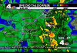
sometimes it's two people trying to do it at the exact same tie. so not a great situation. in termsf connecticut avenue, though, right here at beach drive, it's not too bad. we're seeing traffic moving through the area. it's not an absolute stastill. it's slow, of course, but not an absolute parking lot. so that's good news at least on this roadway. but you're just goingto have to keep your eyes open because you don't necessarily know when you're going to hit a trouble spot and when those brakes go on on the car in front of you, you better be ready to stop. back to you all. >> absolutely. dangerous out there. thanks so much. >> from that radar pictur you can tell that those yellow blobs are still headed our way. let's go back to tom kierein to find out more abouthe approaching rain. >> the yellow and orang you see on the radar. those are the pockets of the heaviest rain. right now light rain in washington as well as montgomery and fairfax and loudoun counties. to our south and east the heaviest rains e falling and
6:47 am

we have a tornado warning that is in effect for about another 15 minutes from a coupleof cells that did show some rotation on the radar. those are beginning to diminish. that's good news. actually could be producing some water spouts over the bay. zooming in, over the chesapeake bay just to get yo oriented, here is the shore of the bay in calvert county and st. mary's coun county. there's point lookout right there. this is the chesapeakeay in here. where you see these areas of orange coming on through, these are the areas of the heaviest rains that are now over the bay. except right here in sthern maryland, they're getting another very heavy downpour. at the pax river naval air station they've had 4 1/2 inches of rain since midnight and still more to come. they could get over seven, maybe even eight inches of rain here before the day is out from these rticular storm that are passing on through coming in from the south, all associated
6:48 am
with what are now the remnants of tropical storm nicole. now,the radar is showing the pockets of heavy rain, also about to come right back in to southern maryland. that is the zone that has been just pounded this morning with rrential downpours, as well as a couple of cells that may be producing water spouts now over the bay, where you see these reds and oranges. that's the heaviest rains, and these two could be producing water spouts just off of point lookout over the bay, as well as just east of lomon. the are tracking off to the north right up the bay. there's another one here that's a little bit of a weaker cell that's just to the east of north beach, and east of calvert county there over the bay. that's heading up towards the bay bridge near annapolis. farther to the north thradar shows another batch of some very heavy rain in anne arundel county from near the calvert county line through shadyside and another band of very heavy rain along interstate 50 in annapolis and farther to the
6:49 am
west there in to northern anne arundel county. these cells are tracking off a little bit to the north and west and so we've had some of that heavier rain pull out of calvert county and move in to extreme eastern prince geor's county. now this may head on up toward the beltway in another 15 minutes. that will cause more traffic problems on the eastern se of the beltway here in prince george's county. this could impact very heavy rain could impact the traffic. communities that are being affected by these particular heavy downpours, and potential perhaps rotation in the atmosphere, ar now into mitchellville in prince george's county, robin wood, woodmore and winchester, those villages and towns could be impacted here up through around 6:00 to 6:55. these are moving rather quickly off to the north, and a little bit to the north and wes and here in prince george's county, and these other
6:50 am
communities here along this path are going to be impactedy this particular cell that's producing some heavy rain. morningside by around 6:55. forestville, kettering around 6:55. district heights perhaps as well, too, largo, that area could get very heavy rain in about another five, six, seven, eight minutes or so, as this tcks off to the north and to the northwest. now, the wider view of the radar showing areas of green,ome lighter rain, thankfully, because we do he flooding reports here. many creeks and streams are out of their banks and all these counties in red we now have flood warnings extended north now into northern maryland and frederick county maryland into montgomery and prince george's as well. southern maryland, heaviest rains this morning,e have had many locatios, well over four inches in charles, calvert, st. mary es, anne arundel and no prince george's.
6:51 am
fairfax, fauquier, you're under a flood waing as well. many reports of water over roads in all of these counties in red, including the district of columbia. rock creek running very high. e've already closed beach drive in many locations. up to seven inches of rain possible all across the entire region. in addition we have a tornado watch that is in effect for eastern virginia the district of columbia, as well as our nearby suburbs and much of maland, the eastern shore. this tornado watch is in effect until 1:00. now a tornado watch means that there's the potential for a storm to produce a funnel cloud, other than the ones we've had showing up on radar, circulation in southern ryland. we don't have any other warnings out right now. for the rest of the day, waves of heavy rain from time to time with temperatures climbs to the mid70s with more flooding likely and perhaps some strong storms. stay tuned. we'll be hereith frequent updates. and then dry out la tonight, storms will be passing by and gone by late this evening and
6:52 am
then partly cloudy tomorrow, and some blustery northwest winds gustg to around 3 mile an hour as high temperatures reach the mid 70s. then a very nice weekend to follow. it will feel like autumn. 40s in the morningaturday and sunday. saturdayafternoon, sunda afternoon both days into the 60s. and then into next week there could be more unsettled weather coming our way. there's quite a bit of uncertainty. stay tuned for that. right ow the biggest concerns are the areas of very heavy rain that continue to fall in calvert, anne arundel, and now into eastern prince george's county as these showers do move off to the north, and a bit to the northwest, our eastern subur are going to have heavy rain in the next few mines. jerry, how is our traffic? >> quite the challenge out there this morning. live look, scroll through some of our trafficcameras and show you this is the outer loop of the beltway a you leave springfield headed toward ice hour avenue and telegraph road. authorities are stl dealing with an accident on the outer loop of the beltway near telegraph road with at least a couple of travel lanes blocked.
6:53 am
again the beltway outer loop delays begin at the i-95 sprgfield interchange. let'shead on over and update you into town, all the southeast corridors are crawling now, pennsylvania aven, 295, on the parkway, this is pennsylvania avenue at seventh street where we're getting initial reports of a pole down on the roadway. pennsylvania avenue near sixth street in northwest, authorities are headed over there. seventh street and new york avenue taffic appears to be moving along pretty well. kind of a hit and miss proposition depending on where you are. through southeast some of the construction areas, particularly at pennsylvania avenue, toward minnesota avenue going to be tough because they are not training at all. to the american legion bridge, ight side and the outer loop are okay. inner loop of the beltway, delays begin just behind the camera as you round the curb toward i-270. authorities continue to deal with the jackknifed tractor trailer on the inner loop of the beltway. after the exit for the i-270
6:54 am

spurt. very little traffic is getting by. plan accordingly. metro is okay, vre, every single vre train is late at this hour. every train on the fredericksburg and manassas line is late because of either flooding or flooding restrictions on vre. m.a.r.c. rail has not notified us of any significant isss at the ment. joe, eun? >> all right, thanks, jerry. >> we're following developing storyut of fairfax county. we have a report of a water rescue aping inannandale at woodburn and tobins road there near fairfax and nova hospital. we understand that emergency crews are on t scene with boats deployed as they're trying to rescue vehicles that have been stranded in high water. >> very dangerous situation out there. be very careful as you dprief around the roadways. obviously if you see what appears to be high water do not go into it. but the big problem is when it's dark outside, raining a lot of glare, it's hard to tell. st be very aware that that's a possibility, and very careful, as tom always says, turn around, don't drown.
6:55 am

let's go to tom right now to find out more about this weather that's continuing to approach our area. >> all this is associated with remnants of tropical storm nicole, which was briefly a tropial storm yesterday. circulation of that storm is way to our south down into north carolina now. but that circulation will pass right over the metro area. right around noontime. so, this is really sort of the beinning of this very heavy rain event. already reports of flooding throughout much of the region. high water on many roads and many basements prone to flooding ma be getting water. right now if you have valuable items in your basement and you know it's prone to flooding, get them into a dry location. as we look at the radar closer into southern maryland is where we've had waves of heavy rain coming through this morning. have reports of over 4 to 4 1/2 inches of rainn st. mary's county and another very strong heavy downpour is just about to move right along the western shores of the bay from st. marys up toward solomons. and from near calvert cliffs up
6:56 am
to north beach, this wave of heavy rain will likely move right up that way hereover the next 15 minutes or so. and this is the radar over the last three hours, so you can see that it has continued to move, and really picked up in intensity. just in the last three hours. now, the radar is showing some pockets of some heavier rain now moving intoprince george's county as well. that pocket of heavy rain is just now crossing route 50 where the beltway meets route 50 over toward annapolis. that is a very heavy rain band there that's heading off to the north. a bit to the northwest. and that may be moving up toward largo and around glendale and perhaps up toward 95 in the next 15 minutes. another pocket of heavy rain just now crossing out of charles countyinto southern prince george's, getting some moderate rain in washington right now. where you see the greens and blues, that's where it's not rning quite as hard. so it's a little bitighter west and north of us thankfully. so the flooding concerns there, at least temporarily, a
6:57 am
beginning to diminish a little bit. but we do have reports of high water in all these counties in red across northern virginia, including washington, as well as much of maryland. reports of high water, flash flood warning means we have floodg occurring right now. the rest of the region, flash flood watch meaning flooding is possible later today. also a tornado wat in effect until 1:00. we couldet some storms producing funnel clouds, eastern virginia, the district, and much of maryland, eastern shore, up until 1:00. more moderate to heavy rain during the afternoon. tapering off tonight and ending by late this evening. and tomorrow as we dry out on friday, partly cloudy cooler weather saturday and sunday int next week a bit unsettled again. how's the traffic? >> time to take a live look as we continue to follow the beltw troubles on the inner loop. the right side of your screen. you'll find delays not too long after you leave the american legion bridge. again on the inner loop headed on over toward old georgewn road. at the scene where authorities are still struggling with the jackknifed tractor trailer. they're telling us, authorities
6:58 am

are telling us only the shlder of the roadway inner loop is getting by. let's update you on 95. more stops and go from triangle most of the way to the capital beltway. lanes are open. if you're making the trip around town, heads up going to be a very long commute. accident downtown. south capital street idge. joe? eun? >> thank you jerry. >>going to be a long commute. going to be a long day weatherwise out there. >> let's go back to tom kierein in the storm center once again f the latest on the storm. tom, good morning. >>ood morning, eun and joe. we've seen these waves of heavy rain really pick up in intensity start about 3:00 this rning. between 3:00 and right now we've had sever waves of heavy rain come through that have unloaded up to 2 to 2 1/2 inches over the last several hours, as a result we've had the waves of rain producing flooding. many small creeks and streams have contind to flow out of their banks, and cover many of the area roads. and where you see the areas of darker green and yellow and orange, that's where we're
6:59 am
getting the heaviest rain. right now we do have that beginning to pick up in intensity in prince george's county. the district of columbia, and in fairfax county. this is one band of a developing heavy rain band at's heading off to the north and west, and will continue to perhaps exacerbate the flooding. also some other areas ef heavier rain beginning to show up around charlottesville. areas to our west that havehad the lighter rain, another band of some heavy rain maying causing flooding out that way. theeaviest rain in anne arundel, calvert couies. >> thanks very much, tom. we will, of course, continue to follow the story all morning long, all day long, but for now that's "news 4 today." good morning,
267 Views
IN COLLECTIONS
WRC (NBC) Television Archive
  Television Archive News Search Service
Uploaded by TV Archive on
